Mount Elden Lookout Trail
 This is the hike I like to take visiting friends on if they are in good shape and the altitude is not bothering them. If they are not in the best of shape, there is a turn off at about a quarter mile to the Fatman’s Loop trail. You can’t miss the sign. This is a loop with little climbing that takes between 60 and 90 minutes.
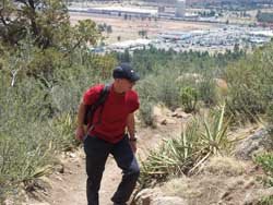
  If you take the Loop turnoff at the sign, you will wind your away around oak, Ponderosa Pines, pinon, fur and alligator bark junipers, through boulder fields, including one really cool squeeze between boulders, and end up at the Mt. Elden Lookout Trail junction. Head down from there, on the Mt. Elden Trail, to the parking lot.
Or, rather than turning off at the Loop sign, take the Mt. Elden Trail up to Lookout Trail/Fatman’s Loop junction and continue through “corduroy cast in stone” and a “staircase of petrified lava,” as Cosmic Ray describes them in his indispensable 50 Favorite Hikes - Flagstaff Sedona, which you can find at bookstores and coffee shops throughout Flag.
 Recently friends who live below sea level in The Netherlands visited, and we hiked my neighborhood mountain. Some hikers don’t like this trail, because you never really escape the sounds of the city below. My Dutch friends were in awe with the spectacular views. There is certainly nothing like this in their country.
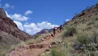
Bringing enough water and salty snacks (always bring water and snacks!), we arrived at the trial head at about 7 am, looked to skies and saw what threatened to be a thunderstorm. You do not want to be climbing up high during a Northern Arizona summer storm. It can be extremely dangerous. So, keeping our eyes on the clouds, we hiked up the Elden Trail, deciding to come down Fatman’s Loop if, indeed, the storm rolled in.
We were lucky; it didn’t. And some ninety minutes later, we reached the top, just past the area that had been devastated in a 1978 and up to where we could see the San Francisco Peaks, the city of Flagstaff, Sunset Crater and the Painted Desert.
If you’re coming to Flagstaff, it’s a hike you won’t want to miss! Book all your hotel reservations here on Flagstaff.Cc.
posted by Hiking Flagstaff @ 2:16 PM
1 comments
![]()
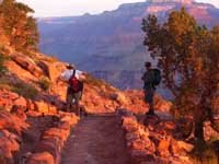 I recently did a one-day Grand Canyon one-day, 21.4 mile rim-to-rim hike. My hiking buddies, and I hiked from the south rim to the north rim. This is not a hike to take lightly. I’ve heard it said that a hike from the south rim to the Colorado River and back up to the rim in one day is the equivalent of a marathon run, yet many people approach such an endeavor as if it’s a walk in the park. The rim-to-rim is even tougher.